🧠 AI tracks down hidden ditches - prevents flooding
By examining altitude models, an AI can determine where there are ditches in the forest. This facilitates the re-creation of wetlands.
Share this story!
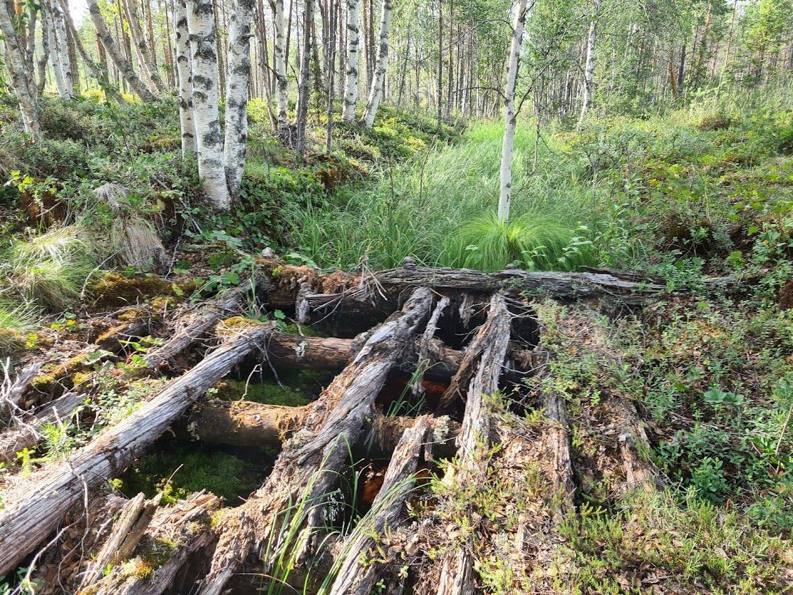
Knowing where the ditches are is important to understand where there is a risk of flooding and where to find the best opportunities to restore wetlands. Unfortunately, only around nine percent of all ditches in Sweden are marked on maps.
But now researchers from the Swedish University of Agricultural Sciences, SLU, together with the Swedish Forest Agency, have produced a map where as many as 85 percent of all ditches are marked. The researchers used deep learning to teach an AI to find these ditches. The AI combined information from national elevation models with information about ditches that had already been marked. In this way, the AI learned to calculate from the height models where the ditches were.
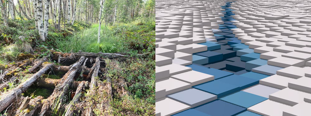
"Now that we know where the ditches are, it is possible to plan for the water in the landscape in more detail. If you put all the ditches in the new map on a long row, the length is enough to cover 24 laps around the earth. The ditches make up about 70 percent of Sweden's watercourses, so it is a big improvement over previous maps", says William Lidberg, researcher at SLU and one of the researchers behind the study, in a press release.
One area of use for the ditch maps is to locate which peatlands are best suited to recreate. Another one is to make sure that forest machines will not get stuck in these ditches.
"If forestry knows where the ditches are, it becomes easier to follow the water's path and avoid causing vehicle-derived damage and nutrient leakage into water", says Liselott Nilsson, GIS specialist at the Swedish Forest Agency.
By becoming a premium supporter, you help in the creation and sharing of fact-based optimistic news all over the world.