🦟 Satellites help predict outbreaks of diseases
20 years ago, foreseeing diseases would be seen as science fiction, but today it is a reality. Through a combination of satellite data and models, researchers can predict outbreaks of mosquito-borne diseases weeks in advance.
Share this story!
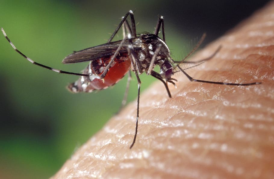
Mosquitoes are excellent carriers of viruses, and along with poor hygienic conditions, the root cause of many human and animal deaths. Between 2004 and 2006, there was an outbreak of the chikungunya virus in the Indian Ocean region caused by unusually hot and dry weather. The virus then spread to 60 countries around the world, and up to 500,000 people became infected. Other viruses, such as cholera, thrive in other weather conditions.
What these viruses, among other things, have in common is that they mainly spread through mosquitoes. Fortunately, researchers are now equipped with satellite data and computer models and can therefore predict the mosquitoes' movements and thus potential outbreaks.
In 2017, a cholera outbreak in Yemen could be predicted with 92% certainty - a region that is not usually affected by the virus. Another example is that researchers were able to predict which cities would suffer the most from cholera after cyclone Idai ravaged Mozambique in 2019.
Researchers have also developed a model that can predict chikungunya outbreaks based on a variety of data. The model called CHIKRisk creates monthly predictions about which parts of the world are most endangered by outbreaks of the virus.
With today's technology, researchers have even managed to predict how dengue fever will spread in the future between 2050 and 2080. In a research report, they write that 2.2 million more people are at risk of contracting dengue fever in 2080 due to, among other things, climate change. Models such as these are important in deciding where to take preventive measures.
The importance of cooperation
In the years leading up to the outbreak in 2017 and the years since organizations such as NASA and UNICEF collaborate with various local organizations and research institutions to develop models that predict disease spread. This is done by examining how climate, weather, and other factors interact and affect the mosquitoes' movements and reproduction. Simultaneously, more satellites are being launched into space to increase surveillance. But despite this, the efforts are still relatively fragmented.
However, the international collaboration continues to grow as more local researchers join in and contribute new data and updates on changes in the local environment. By doing so, collaborations will provide a greater opportunity to warn, for example, local authorities where necessary, so that damage can be prevented through, among other things, decontamination and relocation of healthcare resources even before an outbreak occurs.
John Haynes, Program Manager at NASA's Earth Applied Science Program, states in an article on NASA's website:
"Incorporating satellite observations in disease models has become an innovative concept for epidemiologists and health officials, and it has proven to be a valuable component in making public health decisions".
And he adds:
"A lot more interest has been generated in this field over the past two decades. The use of satellite data in disease models has gone from being relatively foreign to almost mainstream.”
By becoming a premium supporter, you help in the creation and sharing of fact-based optimistic news all over the world.